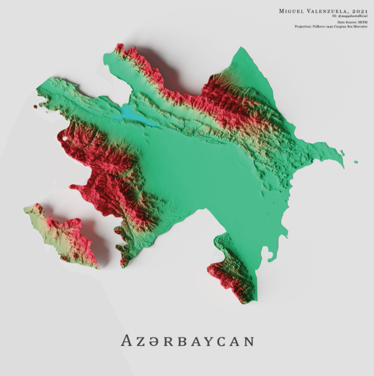
This is a map of Azerbaijan, a former Soviet nation located between Europe and Asia. In this map, the lowlands are marked in green, and high areas are in red.
CountryReports notes that Azerbaijan has a total combined area of 33,436 square miles (86,600 square kilometers). Britannica adds that lowlands make up two-fifths of the country, and more than half of its land has an elevation of 1,300 feet (400 meters) or higher.
The country’s highest point is Mount Bazardüzü, which is located near the country’s border with Russia. It stands at 14,652 feet (4,466 meters) tall.
Help us out by sharing this map:
I don’t think the title of your article matches the content lol. Just kidding, mainly because I had some doubts after reading the article. https://accounts.binance.com/ru/register?ref=O9XES6KU
I don’t think the title of your article matches the content lol. Just kidding, mainly because I had some doubts after reading the article. https://www.binance.com/join?ref=IHJUI7TF
I don’t think the title of your article matches the content lol. Just kidding, mainly because I had some doubts after reading the article.
Thanks for sharing. I read many of your blog posts, cool, your blog is very good.
Thank you for your sharing. I am worried that I lack creative ideas. It is your article that makes me full of hope. Thank you. But, I have a question, can you help me? https://www.binance.com/futures/ref?code=W49FLGDN
Thanks for sharing. I read many of your blog posts, cool, your blog is very good.