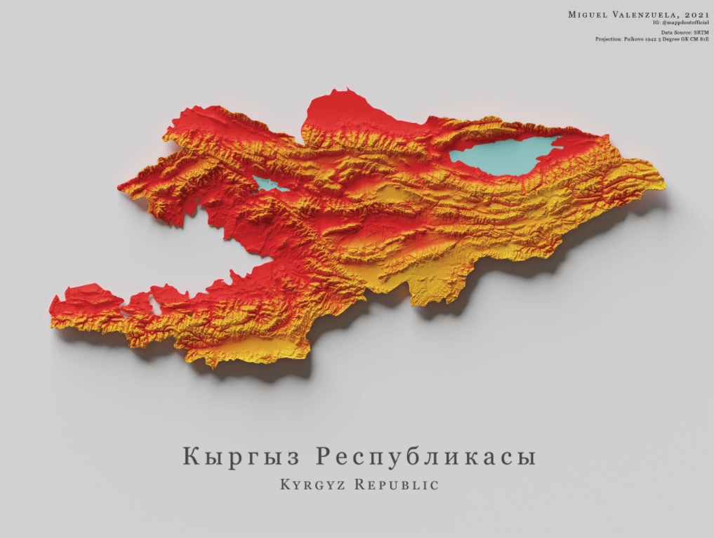
This is a map of the central Asian country Kyrgyzstan. It is shaded according to the country’s bicolor flag, with the lowlands in red and the high areas in yellow.
According to Britannica, the country’s total land area is 77,199 square miles (199,945 square kilometers). The former Soviet state, formally known as the Kyrgyz Republic, is highly mountainous with multiple mountain ranges, hence the high yellow areas being more prominent on the map.
The country’s highest peak is the Victory Peak (Jengish Chokusu), located in the east near the Chinese border. It stands at over 24,000 feet (approximately 7,400 meters) above sea level. Facts and Details notes that the Kara Darya river is the republic’s lowest point, at just 132 m (433 ft) above sea level.
Help us out by sharing this map:
I don’t think the title of your article matches the content lol. Just kidding, mainly because I had some doubts after reading the article.
I don’t think the title of your article matches the content lol. Just kidding, mainly because I had some doubts after reading the article. https://www.binance.com/register?ref=IXBIAFVY
Thanks for sharing. I read many of your blog posts, cool, your blog is very good. https://www.binance.info/bn/register?ref=WTOZ531Y
I don’t think the title of your article matches the content lol. Just kidding, mainly because I had some doubts after reading the article.
Can you be more specific about the content of your article? After reading it, I still have some doubts. Hope you can help me.
Thank you for your sharing. I am worried that I lack creative ideas. It is your article that makes me full of hope. Thank you. But, I have a question, can you help me?
I don’t think the title of your article matches the content lol. Just kidding, mainly because I had some doubts after reading the article. https://accounts.binance.bh/register/person?ref=JW3W4Y3A
Your article helped me a lot, is there any more related content? Thanks!