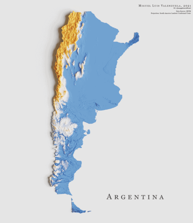
This is a topographic map of Argentina, featuring its various landforms.
ThoughtCo says that the South American country of over 44 million people has a total land area of 1,073,518 square miles (2,780,400 square kilometers).
There is a vast amount of lowland in most of the country, which is marked in blue.
The western part of the country, the Andes region, is mountainous (marked in yellow). Within the range lies the Aconcagua mountain, Argentina’s highest peak. Located within the country’s border with Chile, it stands at over 22,800 feet (6,900 meters), according to Britannica.
Help us out by sharing this map:
2 thoughts on “Argentina Topography Map”