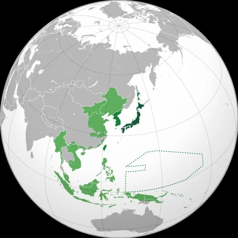
The Japanese Empire at Its Peak: Understanding the 1942 Pacific Dominance
Map by Milenioscuro / Wikimedia Commons In 1942, the Japanese Empire reached its maximum territorial expansion during World War II. …
Read moreOver 2 decades of remodeling experience, Joe is an expert in home improvement. He is now the Managing Editor of PlumbJoe where he writes guides for homeowners. His hobbies include climbing, running and playing the piano.
Map by Milenioscuro / Wikimedia Commons In 1942, the Japanese Empire reached its maximum territorial expansion during World War II. …
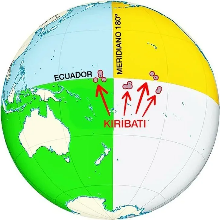
Read moreMap found here When it comes to geography trivia that sounds too bizarre to be true, Kiribati takes the crown. …
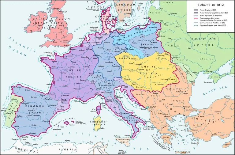
Read moreMap by Alexander Altenhof / Wikimedia Commons Looking at Europe in 1812 is like witnessing the moment before everything changed. …
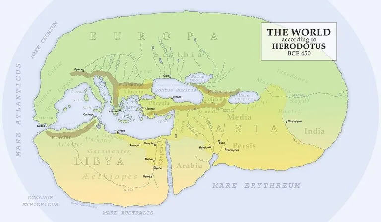
Read moreMap found on Wikimedia Commons When Herodotus sat down to document the known world around 450 BC, he wasn’t just …
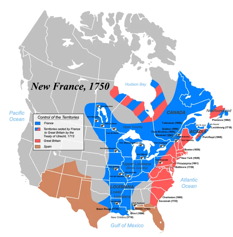
Read moreMap by JF Lepage / Wikimedia Commons Imagine this: it’s 1750, and if you’re standing anywhere from Quebec to New …
Read moreMap by Heraldry / Wikimedia Commons Ever looked at a map and wondered what North America might have looked like …
Read more