England’s Musical Map: The Artists Who Put Each County on the World Stage
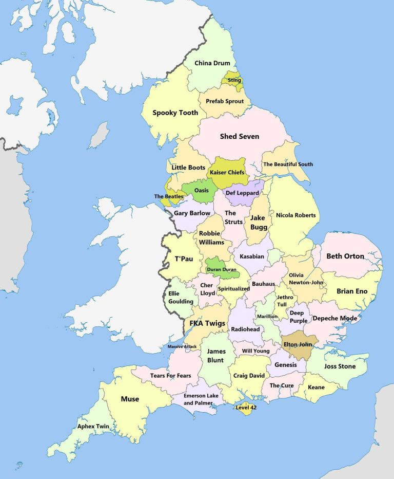
Map by Reddit user uvbseventysix Ever wondered which corner of England gave us your favorite artists? This fascinating map reveals …
Map by Reddit user uvbseventysix Ever wondered which corner of England gave us your favorite artists? This fascinating map reveals …
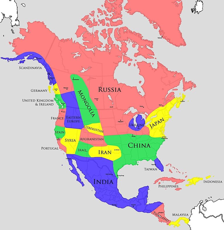
Map by Reddit user TurbulentTruth Ever wondered why Minneapolis winters feel so brutally cold while cities at the same latitude …
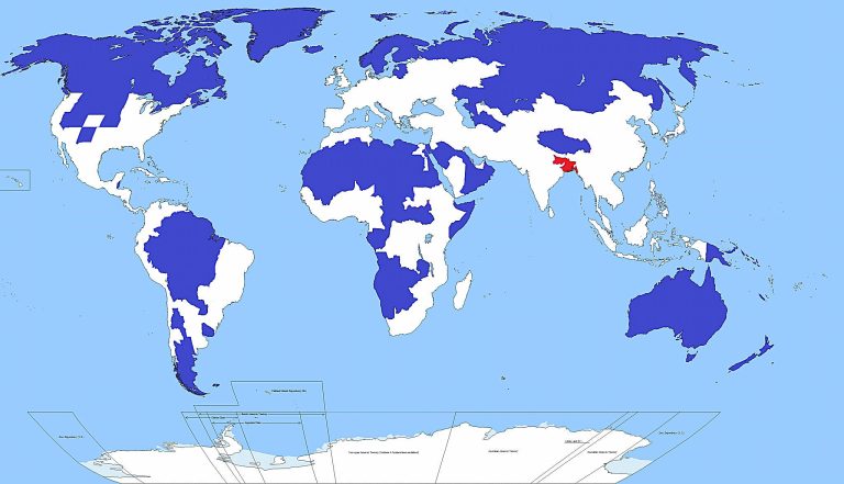
Map by Reddit user MohanBhargava Take a long look at this map. That tiny red area in Asia contains more …
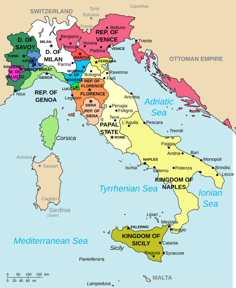
Map by Ultimate Destiny / Wikimedia Commons Looking at this fascinating map of Italy in 1494, it’s striking how dramatically …
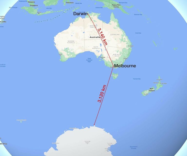
Map by Reddit user Improv92 Looking at this map, your brain might need a moment to process what you’re seeing. …
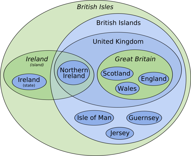
Map by TWCarlson / Wikimedia Commons The British Isles can be confusing territory, both literally and figuratively. This clever Euler …