The Japanese Empire at Its Peak: Understanding the 1942 Pacific Dominance
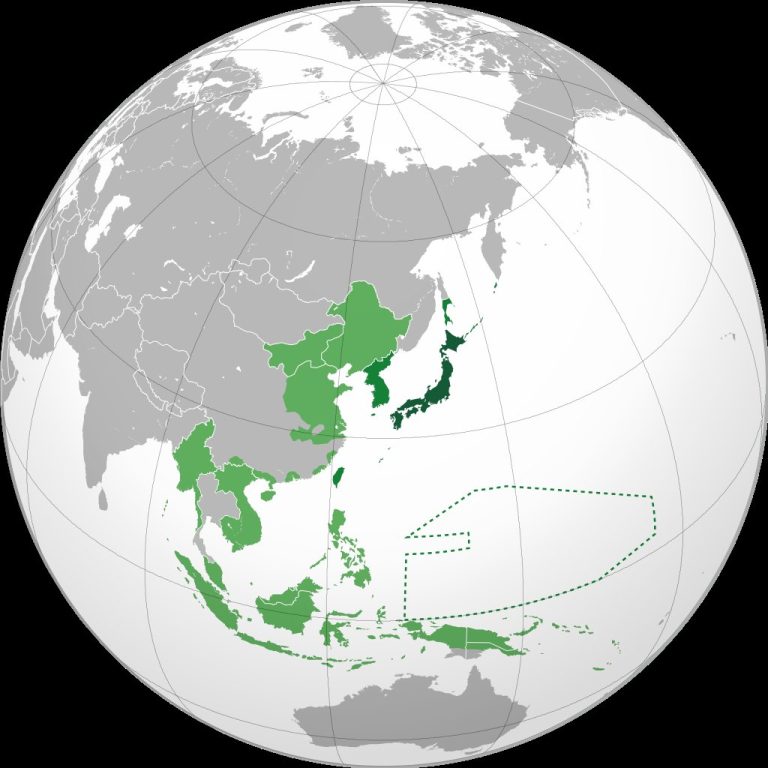
Map by Milenioscuro / Wikimedia Commons In 1942, the Japanese Empire reached its maximum territorial expansion during World War II. …
Map by Milenioscuro / Wikimedia Commons In 1942, the Japanese Empire reached its maximum territorial expansion during World War II. …

Map found here When it comes to geography trivia that sounds too bizarre to be true, Kiribati takes the crown. …
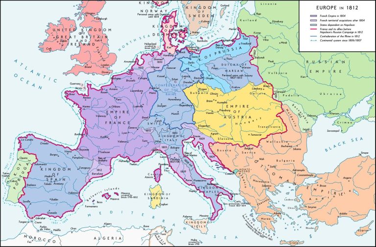
Map by Alexander Altenhof / Wikimedia Commons Looking at Europe in 1812 is like witnessing the moment before everything changed. …
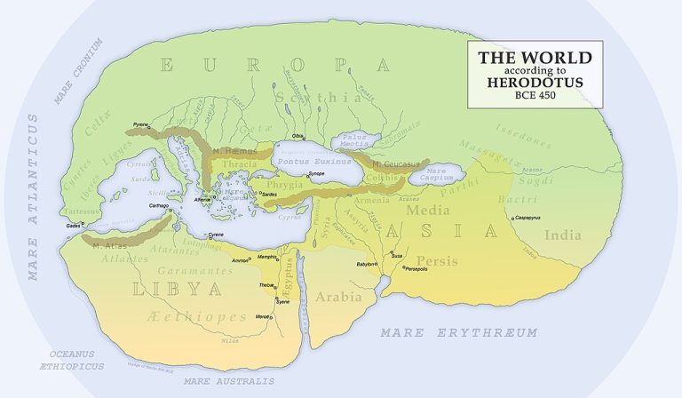
Map found on Wikimedia Commons When Herodotus sat down to document the known world around 450 BC, he wasn’t just …
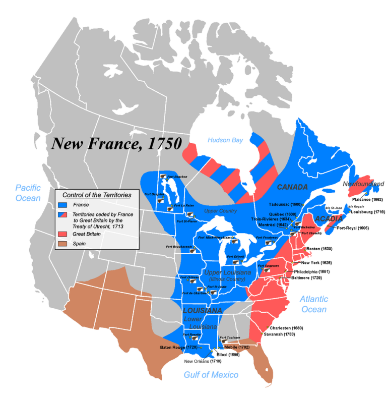
Map by JF Lepage / Wikimedia Commons Imagine this: it’s 1750, and if you’re standing anywhere from Quebec to New …

Map by Heraldry / Wikimedia Commons Ever looked at a map and wondered what North America might have looked like …