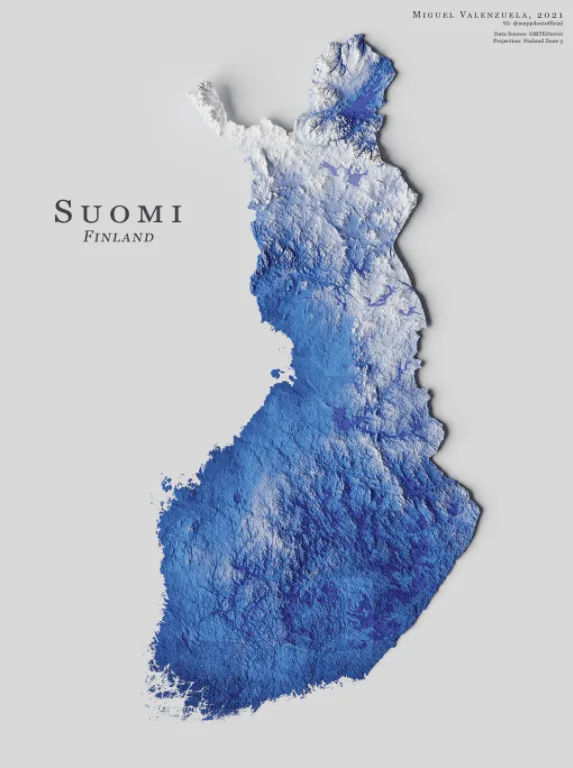
This is a topographic map of Finland, one of the Scandinavian countries in northern Europe.
The republic of over 5.5 million residents has a total land area of 150,928 square miles (390,903 square kilometers), according to Britannica.
Finland boasts a landscape of mostly forests. The country’s highest peak is Mount Halti, which stands at 4,357 feet (1,328 meters) tall.
Help us out by sharing this map:
Can you be more specific about the content of your article? After reading it, I still have some doubts. Hope you can help me. https://www.binance.com/ar-BH/register?ref=S5H7X3LP
Your article helped me a lot, is there any more related content? Thanks!
Your article helped me a lot, is there any more related content? Thanks!
Thanks for sharing. I read many of your blog posts, cool, your blog is very good.
I don’t think the title of your article matches the content lol. Just kidding, mainly because I had some doubts after reading the article.