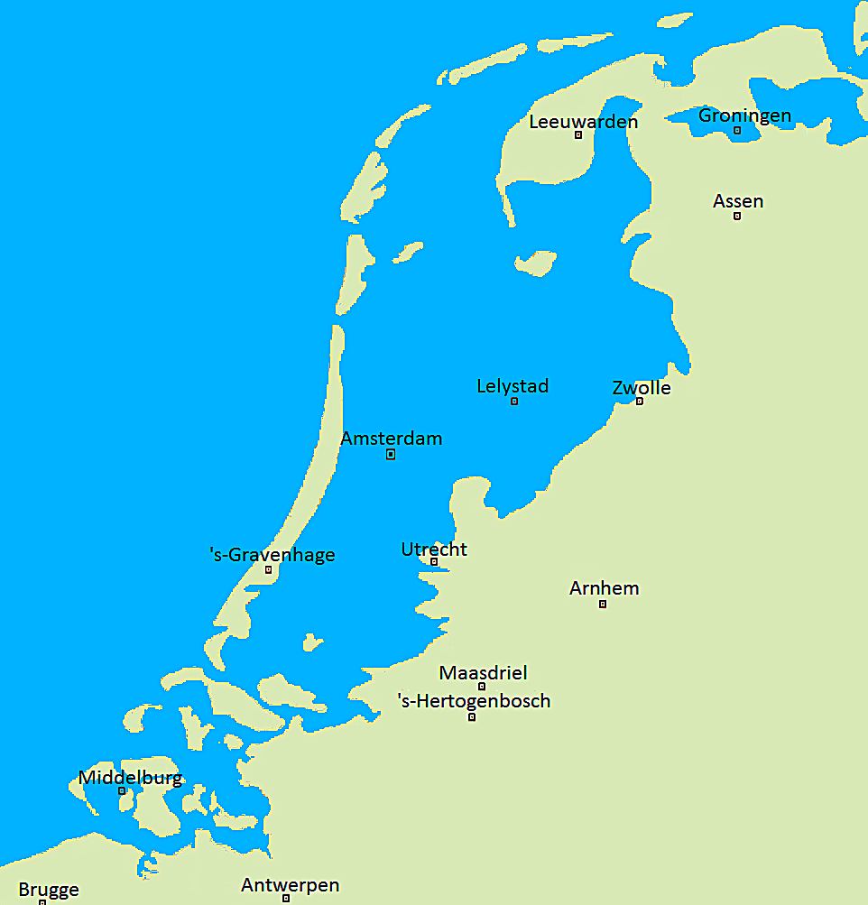
Map by Jan Arkesteijn / Wikimedia Commons
Ever wondered what would happen if the Netherlands suddenly lost its centuries-old battle against the sea?
This fascinating map shows us exactly that scenario, revealing a dramatically different landscape where much of the country disappears beneath the waves.
A Nation Built on Borrowed Land
The Netherlands has spent over a thousand years literally creating itself.
Through an intricate system of dikes, pumps, and polders, the Dutch have reclaimed massive amounts of land from the sea. About 26% of the country currently sits below sea level, with some areas lying as much as 22 feet beneath the waves.
Without these engineering marvels, cities like Amsterdam would become islands, while major population centers including Utrecht, The Hague, and Rotterdam would vanish entirely underwater. The famous Dutch countryside, with its flat fields and grazing cattle, would return to its natural state as part of the North Sea.
The Great Drowning
Looking at this map, you can see how the sea would rush back to claim what was once its domain.
The entire western region, known as the Randstad and home to over 7 million people, would disappear beneath the waves. Only the higher eastern and southern regions around cities like Arnhem, Maastricht, and parts of Groningen would remain above water.
The transformation would be stunning. Instead of a densely populated lowland country, we’d see a collection of islands scattered across what is now one of Europe’s most developed regions. The iconic Dutch landscape of canals, windmills, and tulip fields would be replaced by open ocean dotted with small landmasses.
Engineering Marvel Under Threat
This scenario isn’t just academic speculation. Climate change and rising sea levels make the Dutch water management system more critical than ever.
The country invests billions of euros annually in maintaining and upgrading its flood defenses, including the impressive Delta Works, often called one of the Seven Wonders of the Modern World.
The Dutch have become world leaders in water management precisely because they’ve had to be. Their expertise is now being exported globally as other coastal nations face similar challenges from rising seas and extreme weather events.
A Reminder of Human Ingenuity
This map serves as a powerful reminder of human determination and engineering prowess. The Netherlands as we know it today exists because generations of people refused to accept the natural boundaries imposed by the sea. They literally moved mountains, or in this case, moved oceans, to create the land they needed.
Next time you see those charming Dutch windmills or cycle through Amsterdam’s streets, remember that you’re experiencing one of humanity’s greatest triumphs over nature. Without constant vigilance and maintenance, this entire landscape could return to the sea in a matter of years.
Help us out by sharing this map: