What’s Beneath Your Feet? A Rock-Solid Tour of Britain and Ireland’s Geology
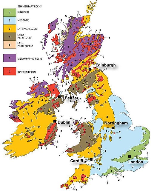
Map from the British Geological Survey If you’ve ever wondered why the Scottish Highlands look so dramatically different from the …
Map from the British Geological Survey If you’ve ever wondered why the Scottish Highlands look so dramatically different from the …
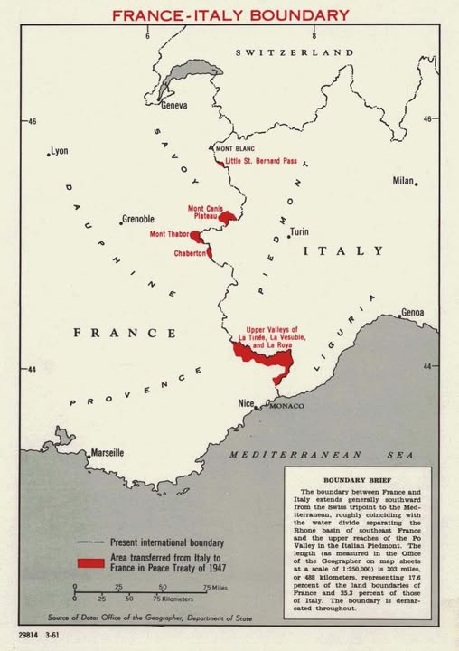
Map created by the U.S. Department of State (Public Domain) Most people know World War II ended in 1945, but …
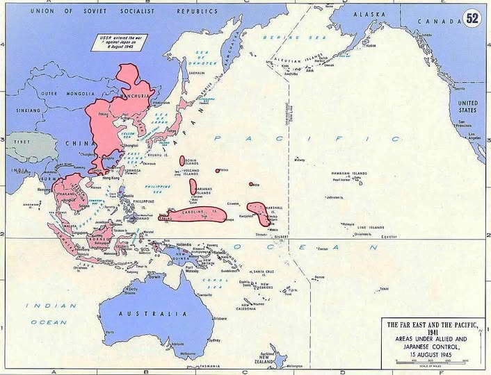
Map found on the Asia Maritime Transparency Initiative This remarkable map, labeled “The Far East and the Pacific: Areas Under …
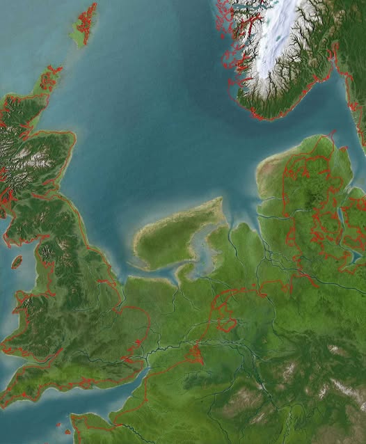
Map from RMO Look at the map above, and something feels slightly off. Britain is connected to Europe. The North …

Data from gciruelos.com Ever wondered which countries look the most like circles? Thanks to some clever mathematical analysis, we now …

Photo by NASA Here’s a mind-bending fact to reset your perspective: the United States hasn’t even existed for one complete …