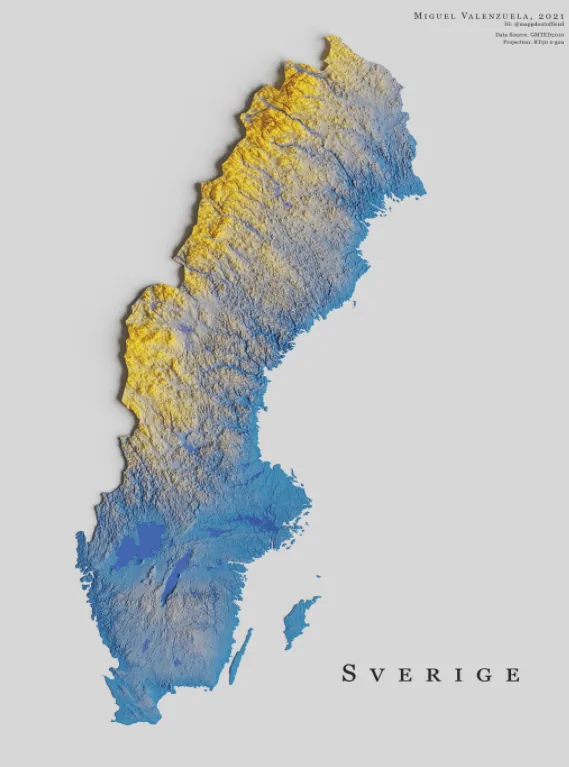
This is a map of Sweden. It showcases the Scandinavian country’s topography and is colored according to its bicolor flag. The high areas are in yellow, and the lowlands are in blue.
The country is divided into three main regions: Norrland, Svealand, and Götaland. The capital city of Stockholm is located in the central region, Svealand.
Studying in Sweden notes that Sweden has a total land area of almost 450,000 square kilometers (approximately 173,000 square miles). In terms of landmass, this makes the country the largest in northern Europe and the Scandinavian region, the fourth largest in all of Europe, and the 55th largest in the world.
The yellow area in the west is part of the Scandinavian Mountains, which Sweden shares with Norway. Situated in the north is the mountain Kebnekaise, the highest peak in the country, at 2,111 meters (6,926 feet) above sea level, notes Britannica.
Help us out by sharing this map:
10 thoughts on “Sweden Topography Map”