Map by Miguel Valenzuela
When you think of Thailand, your mind probably wanders to pristine beaches, bustling Bangkok streets, or ancient temples nestled in jungle canopies.
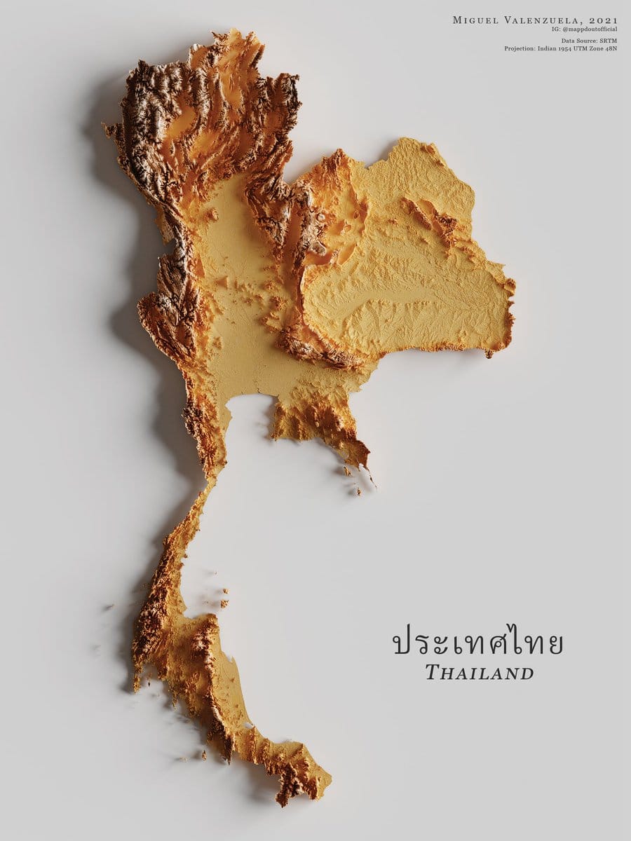
But have you ever considered what the country actually looks like from a topographic perspective?
This beautifully crafted 3D representation shows Thailand’s diverse terrain in a way that’s both scientifically accurate and visually captivating.
Created by Miguel Valenzuela using SRTM (Shuttle Radar Topography Mission) data, this elevation map transforms raw geographical information into something that resembles a piece of golden, crispy artwork. The texture and color gradient aren’t just aesthetic choices but represent actual elevation changes across the country.
Reading the Landscape
The darker, more textured areas you see concentrated in the northern and western regions represent Thailand’s mountainous terrain.
This is where you’ll find the country’s highest peaks, including Doi Inthanon, which reaches 2,565 meters above sea level. These mountain ranges form natural borders with Myanmar and Laos, creating the dramatic landscapes that northern Thailand is famous for.
The smoother, lighter central area depicts the vast Chao Phraya River basin, home to Bangkok and Thailand’s agricultural heartland. This is some of the flattest, most fertile land in Southeast Asia, which explains why this region has been the center of Thai civilization for centuries.
Notice that slender southern peninsula? That’s where Thailand extends down toward Malaysia, characterized by relatively low elevation but punctuated by limestone karsts and coastal mountains that create the iconic scenery of places like Krabi and Phang Nga Bay.
The Science Behind the Beauty
The SRTM data that formed the basis of this map was collected during an 11-day Space Shuttle mission in 2000. Using radar technology, the mission mapped approximately 80% of Earth’s land surface with unprecedented accuracy.
When this data is rendered in three dimensions with appropriate vertical exaggeration, you get these stunning relief maps that make elevation differences immediately obvious.
The golden, toasted appearance isn’t just artistic license. It helps our eyes distinguish between subtle elevation changes that might otherwise be difficult to perceive. The darker ridges emphasize the sharpest topographic features, while the lighter valleys and plains recede into the background.
Geography Shapes Everything
Looking at Thailand this way reminds us how profoundly geography influences culture, economy, and history. The mountains isolated different ethnic groups and created distinct regional identities. The central plains enabled rice cultivation that fed empires. The coastal geography facilitated maritime trade that brought wealth and foreign influences.
Next time you see a standard political map of Thailand, remember there’s a whole dimension of peaks, valleys, and plateaus beneath those flat borders. Geography isn’t just about locations; it’s about the shape of the land itself and how it molds everything that happens on its surface.
Help us out by sharing this map: