
This is an elevation map of Greece. The map also features the country’s topography or land features.
According to Britannica, the southern European country, which is formally known as the Hellenic Republic, has a total land area of 50,949 square miles (131,957 square kilometers).
The highly-elevated areas in the country are shaded in blue. The country’s highest point is Mount Olympus, which stands at 9,570 feet (2,917 meters) tall.
Help us out by sharing this map:
You May Also Like:
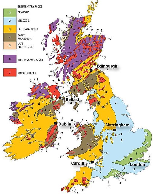
What's Beneath Your Feet? A Rock-Solid Tour of Britain and Ireland's Geology
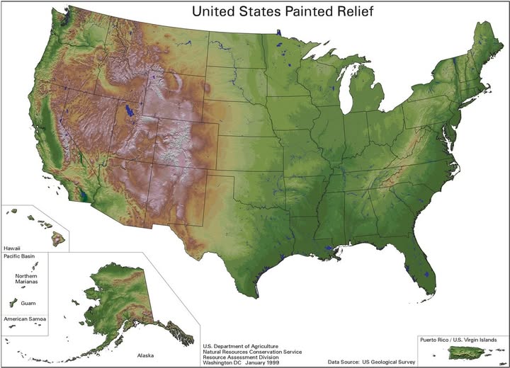
America's Hidden Terrain: What the Land Actually Looks Like Beneath Your Feet

The Staggering Human Cost of World War II Across Europe

The World's Roundest Countries: Sierra Leone Takes the Crown
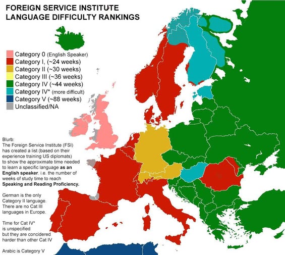
How Long Does It Actually Take to Learn a European Language? The FSI Has the Answer

Europe's Green Divide: The Surprising Story of Where Trees Really Grow
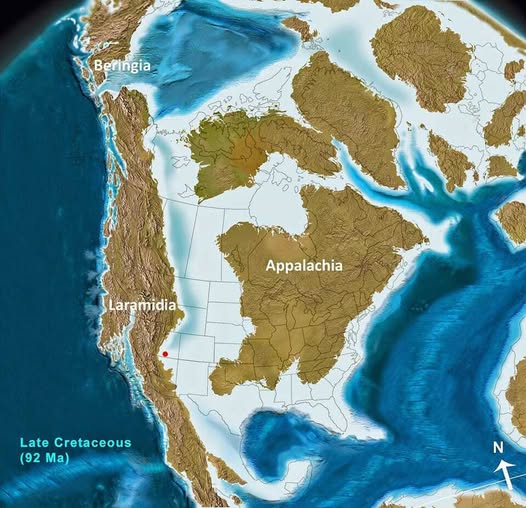
When North America Was Two Islands: The Forgotten World of the Late Cretaceous

Your article helped me a lot, is there any more related content? Thanks! https://accounts.binance.info/register-person?ref=IHJUI7TF
Your point of view caught my eye and was very interesting. Thanks. I have a question for you. https://accounts.binance.info/pt-BR/register-person?ref=GJY4VW8W
I don’t think the title of your article matches the content lol. Just kidding, mainly because I had some doubts after reading the article.
Thanks for sharing. I read many of your blog posts, cool, your blog is very good.