
This is a map of South Africa detailing the population density in each of the country’s provinces.
More than 59 million people live in South Africa, according to Worldometer.
Statista estimates that some 15 million of them are in the Gauteng province. This is where two major cities are located: Pretoria, the country’s seat of government, and Johannesburg, the nation’s largest city.
Help us out by sharing this map:
You May Also Like:
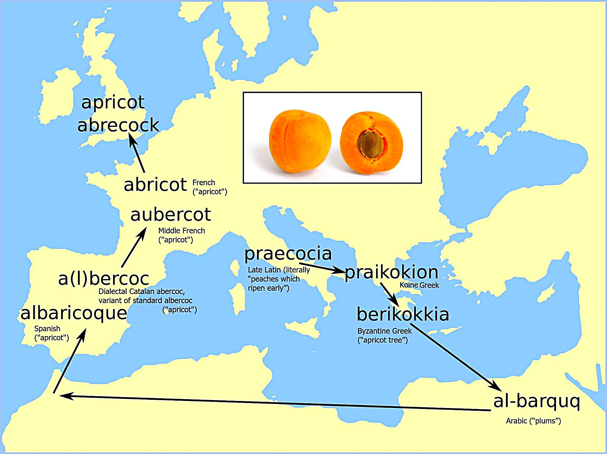
The Sweet Journey: How 'Apricot' Traveled From Ancient Greece to Your Kitchen

Why America Writes Dates Backwards: The US and Its Unique Calendar Format
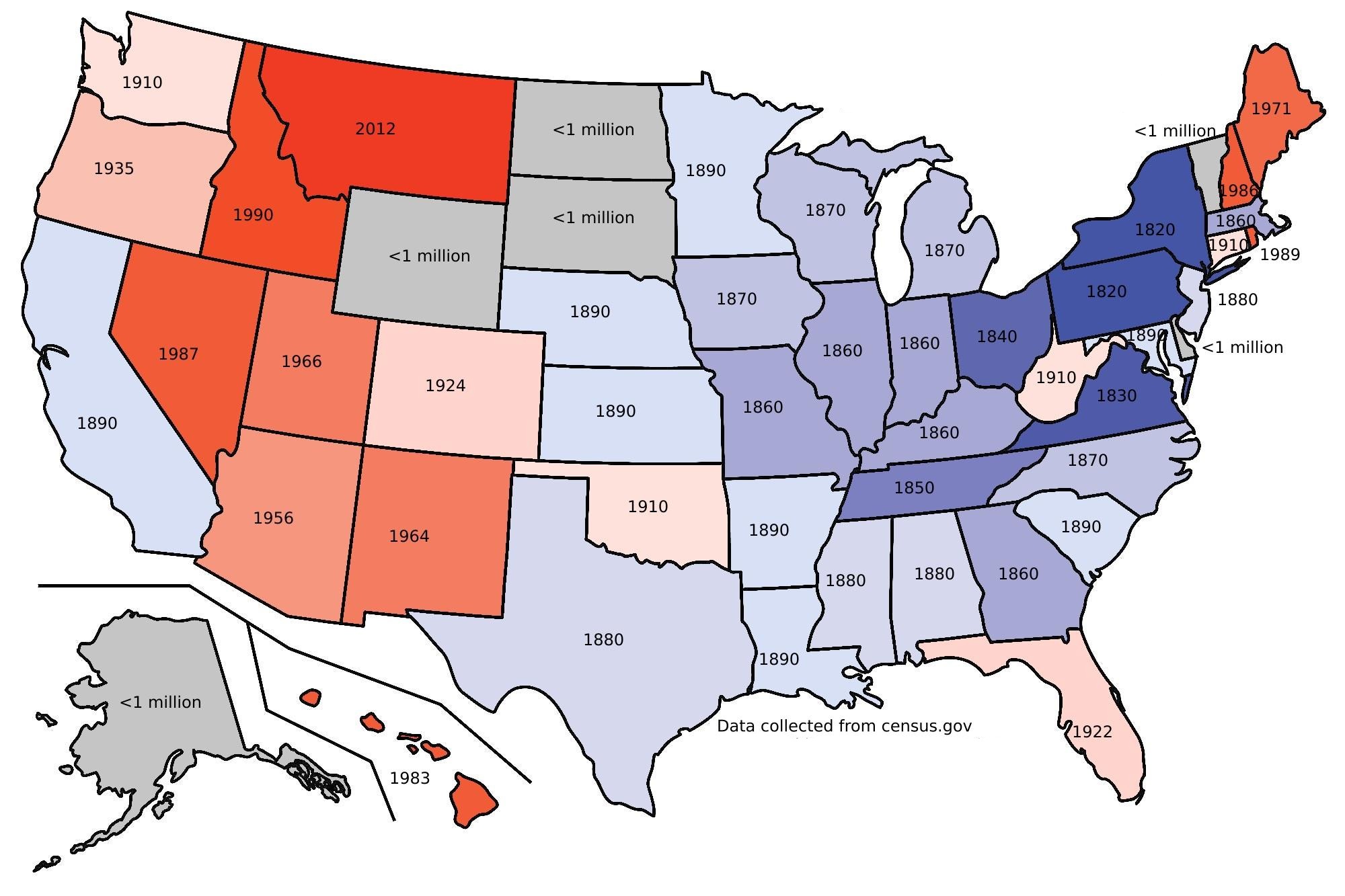
When Did Your State Hit 1 Million People? A Census Journey Through American Growth
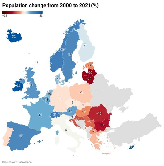
Europe's Population Puzzle: Who's Growing, Who's Shrinking?
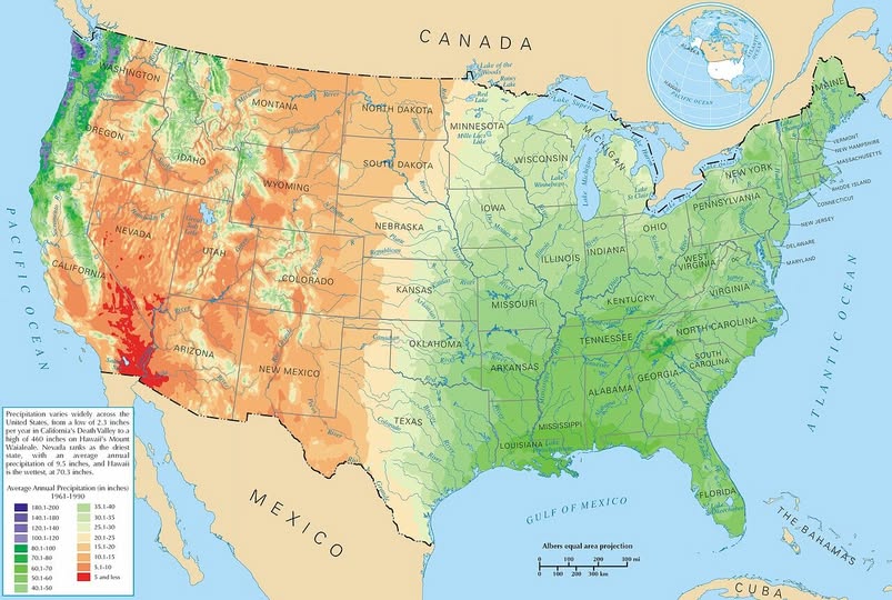
Where Does It Rain in America? A State-by-State Guide to U.S. Precipitation

The Surname Map: How England and Wales Divided by Family Names in 1881

Texas vs. Poland: A Surprising Size Comparison That'll Change How You See the Lone Star State
Your article helped me a lot, is there any more related content? Thanks!
Your point of view caught my eye and was very interesting. Thanks. I have a question for you. https://accounts.binance.info/ro/register?ref=HX1JLA6Z
I don’t think the title of your article matches the content lol. Just kidding, mainly because I had some doubts after reading the article. https://accounts.binance.info/register/person?ref=QCGZMHR6
I don’t think the title of your article matches the content lol. Just kidding, mainly because I had some doubts after reading the article.
Your point of view caught my eye and was very interesting. Thanks. I have a question for you.
Your article helped me a lot, is there any more related content? Thanks!
Thanks for sharing. I read many of your blog posts, cool, your blog is very good.