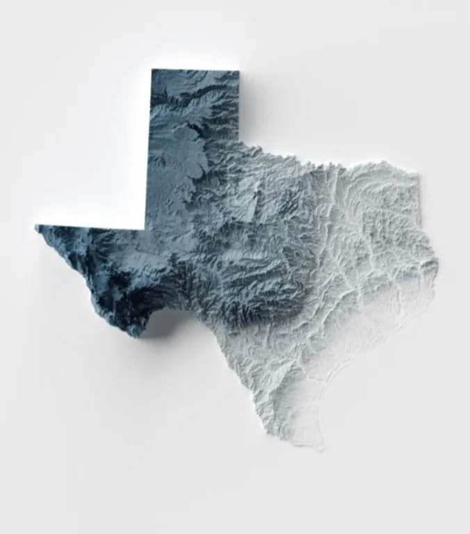
This is a topographic map of the U.S. state of Texas, featuring its various landforms.
The Lone Star State has a total land area of 268,597 square miles (695,662 square kilometers), as noted by Britannica. It added that the state’s north and south borders stretch 1,000 miles (1,600 kilometers); the same measurement goes for its west to east borders.
The 28th state’s highest point is the Guadalupe Peak, part of its namesake mountain range. It peaks at 8,749 feet (2,667 meters) and is located in the state’s western region near the border with New Mexico.
Help us out by sharing this map:
Can you be more specific about the content of your article? After reading it, I still have some doubts. Hope you can help me.
I don’t think the title of your article matches the content lol. Just kidding, mainly because I had some doubts after reading the article.
Your article helped me a lot, is there any more related content? Thanks!
Do you mind if I quote a couple of your posts as long as I provide credit and sources back to your weblog?
My website is in the exact same area of interest as yours and
my users would certainly benefit from some of the information you provide
here. Please let me know if this ok with you.
Thanks a lot!
Thank you for your sharing. I am worried that I lack creative ideas. It is your article that makes me full of hope. Thank you. But, I have a question, can you help me?
Your article helped me a lot, is there any more related content? Thanks! https://www.binance.bh/register?ref=JW3W4Y3A
Your point of view caught my eye and was very interesting. Thanks. I have a question for you. https://accounts.binance.bh/register/person?ref=GGYHGRE
lizenzierte deutsche online casinos
Feel free to visit my homepage … live casino sofortüberweisung (https://Biodent.Odosdigital.cl/2025/10/06/casino-deutsch-spiele-2026/)