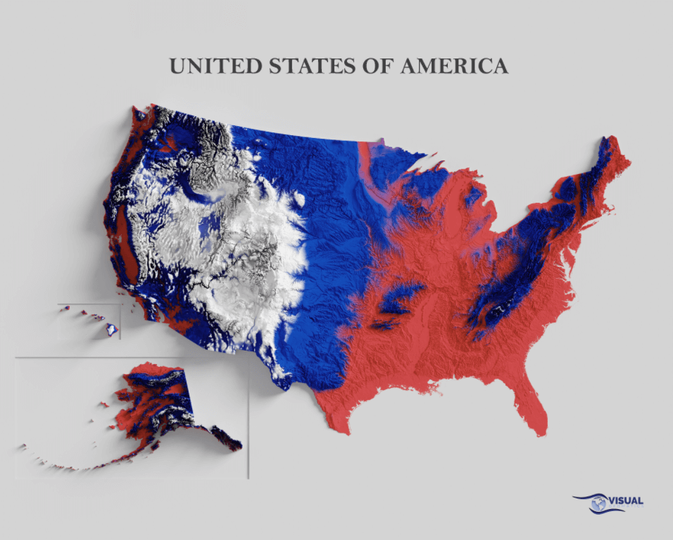
This is a relief map of the United States, featuring its topography and shaded according to its tricolor flag. The map includes the mainland U.S., as well as Alaska and Hawaii.
The U.S. is the third-largest country in the world in terms of total land area, measuring more than 3.7 million square miles (9.8 million square kilometers).
The red areas on the map are the lowlands. The ones in blue are the hills and low mountains in the east, and the central Great Plains in the mainland, according to ThoughtCo. The white areas are high mountainous regions, such as the ones in Alaska, Hawaii, and the western mainland.
The Denali mountain in southern Alaska is the highest point in the country. National Geographic lists its peak at 6,190 meters (20,130 feet), which also makes it the tallest peak in North America.
Nat Geo also notes that the Death Valley in the Mojave Desert in California is the lowest point in the United States. Dubbed as the “hottest, driest, and lowest national park” by the U.S. National Park Service, it measures 282 feet (86 meters) below sea level.
Help us out by sharing this map:
You May Also Like:
When Tokyo Could Swallow London: A Tale of Two Megacities
Australia's Habitability Map from 1946: A Snapshot of Where People Could Actually Live

The Surname Map: How England and Wales Divided by Family Names in 1881
U.S. River Flow Rate Map: The Surprising Truth About the Liquid Highways That Move the Most Water

Europe's Capital Cities: A Visual Guide to Urban Sprawl

When the Entire Internet Fit on a Single Page: The ARPANET Map of 1973
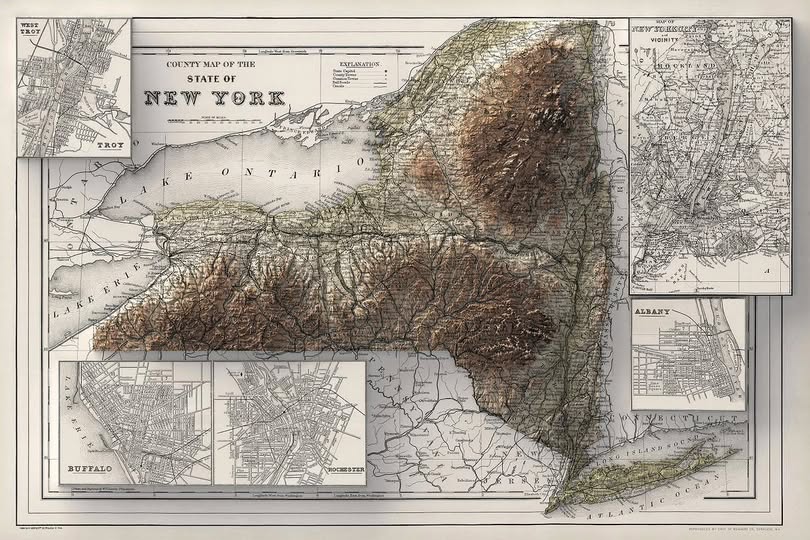
When New York Was Young: The County Map That Captured a State in Motion
Your point of view caught my eye and was very interesting. Thanks. I have a question for you.
Your point of view caught my eye and was very interesting. Thanks. I have a question for you. https://accounts.binance.info/uk-UA/register?ref=XZNNWTW7
Thank you for your sharing. I am worried that I lack creative ideas. It is your article that makes me full of hope. Thank you. But, I have a question, can you help me? https://www.binance.com/register?ref=IHJUI7TF
Your point of view caught my eye and was very interesting. Thanks. I have a question for you. https://www.binance.bh/register?ref=JW3W4Y3A
Your point of view caught my eye and was very interesting. Thanks. I have a question for you. https://accounts.binance.info/ph/register/person?ref=IU36GZC4
Your article helped me a lot, is there any more related content? Thanks!
This is a fascinating map that makes the geography of the United States easy to understand at a glance. The color shading highlights the country’s diverse landscapes, from vast lowlands to towering mountain ranges, making it both informative and visually impressive.
Here the information about the US relief map is easy to follow, and visual presentation makes it much more engaging,clear explanations and helpful visuals, thanks for sharing this useful information!
Thank you for your sharing. I was worried about lacking creative ideas, but your article has inspired me and filled me with fresh hope. The way you explained the topic is encouraging and shows how valuable perspectives can spark new thoughts.
They are discussing an article about a shaded relief map of the U.S. It explains the map’s color scheme: red for low-lying plains, blue for hills and vast plains, and white for high mountains. The map uses colors to depict different terrains. This article is very interesting; I hope everyone reads it and gains valuable information. Thank you.
The color scheme makes the elevation changes much easier to notice than a regular political map. What caught my attention is how the western mountain regions stand out compared with the flatter central areas. Alaska and Hawaii also make the overall picture a little harder to read at first, since their geography is so different from the mainland. I’d be curious to see the same relief map without the flag colors, just to compare how much the shading itself shows the terrain.
Thank you for your sharing. I am worried that I lack creative ideas. It is your article that makes me full of hope. Thank you. But, I have a question, can you help me?
A stunning representation of the United States’ physical landscape, this map combines art and geography. From the peaks of Denali to the depths of Death Valley, it reveals the incredible range of terrains found across the nation.
I appreciate the effort behind this post, as it offers useful details and helpful knowledge. The article explains the geography and topography of the United States in an engaging way, highlighting important landmarks, elevations, and natural features for readers to understand.
I don’t think the title of your article matches the content lol. Just kidding, mainly because I had some doubts after reading the article. https://accounts.binance.bh/es-LA/register?ref=VDVEQ78S
Your point of view caught my eye and was very interesting. Thanks. I have a question for you. https://www.binance.com/futures/ref?code=JW3W4Y3A
Thanks for sharing. I read many of your blog posts, cool, your blog is very good.
Can you be more specific about the content of your article? After reading it, I still have some doubts. Hope you can help me.