Map found on Reddit
Looking at this fascinating map, it’s striking how the Romans didn’t just conquer territories; they built the infrastructure that would define European civilization for millennia.
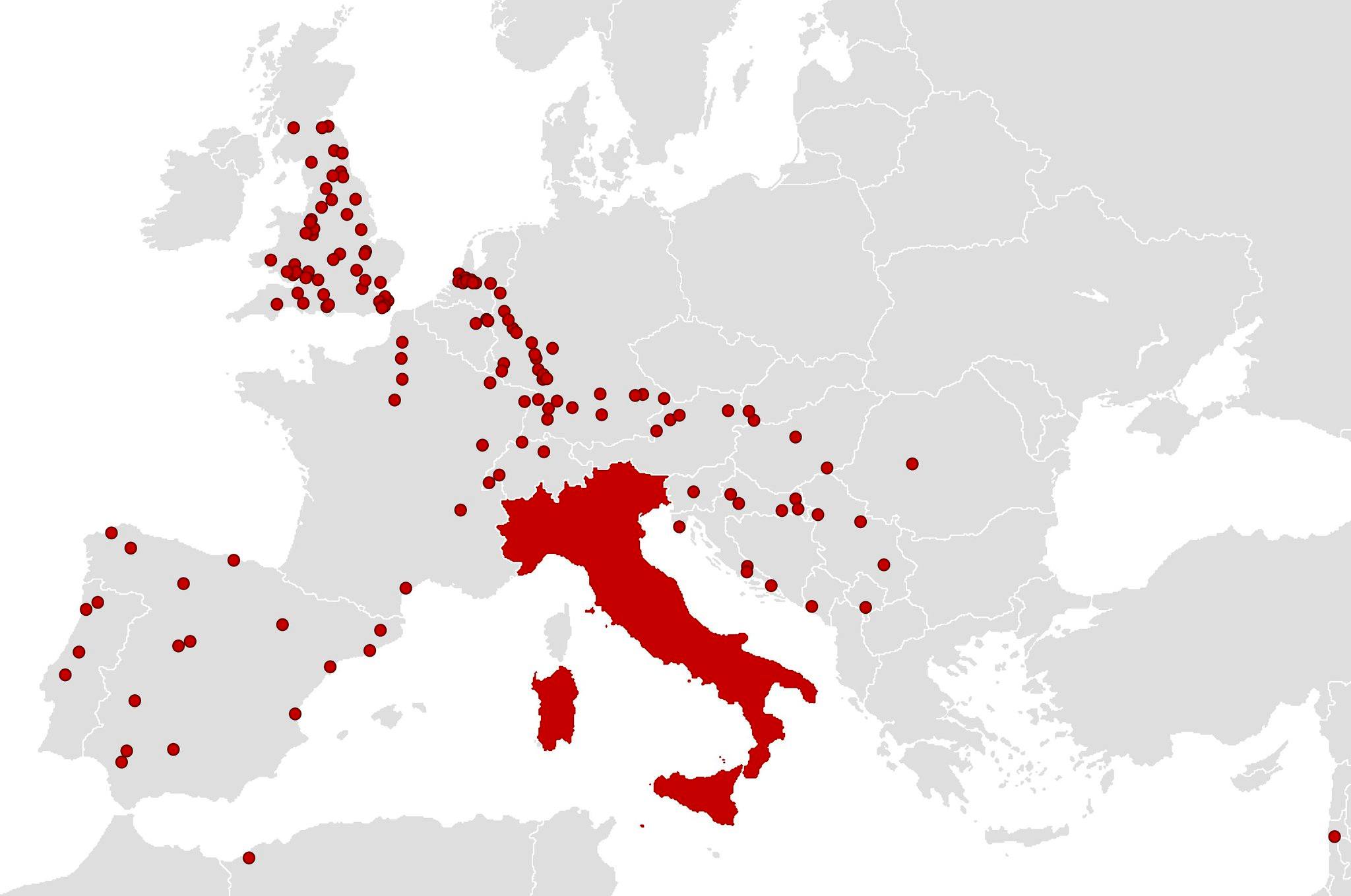
Each red dot represents a city founded by Roman hands, and Italy’s distinctive boot shape stands out in solid red, showing the empire’s heartland surrounded by hundreds of settlements that began as Roman outposts.
Following the Legions: Where Rome Built Its Cities
The pattern tells an incredible story of imperial strategy.
Notice how densely packed the dots are along what we now call France, particularly in the south, where Roman influence was strongest. The Rhine frontier in Germany shows a clear line of fortified settlements, while Britain’s southern coast is dotted with Roman foundations that became major English cities.
Spain’s Mediterranean coast and interior valleys reveal extensive Roman colonization, while the scattered points across the Balkans and along the Danube show how Rome secured its eastern borders through urban development.
Even distant outposts in North Africa and the edges of the empire got their Roman cities, each serving as an anchor point for Roman law, culture, and trade.
More Than Just Military Camps
These weren’t temporary military installations. The Romans understood that lasting control required civilian populations, economic centers, and cultural assimilation.
Many of these red dots represent cities that are still thriving today: Paris, London, Vienna, Barcelona, Cologne, and dozens of others trace their origins directly to Roman urban planners who surveyed the land over two thousand years ago.
The Romans brought their signature urban elements everywhere they went: forums for commerce and politics, amphitheaters for entertainment, aqueducts for fresh water, and grid street patterns that many European city centers still follow today.
They established local governments, built roads connecting each settlement to the broader imperial network, and created marketplaces where Roman merchants could trade with local populations.
The Blueprint for European Civilization
What’s remarkable about this map is how it essentially previews the future of European development. The Romans had an uncanny ability to identify locations with lasting strategic and economic value. River crossings, natural harbors, defensible hills, fertile valleys, and mineral deposits all attracted Roman city builders who understood geography in ways that still impress modern urban planners.
This visual representation shows us that Roman expansion wasn’t just about military conquest; it was about creating a sustainable urban civilization that could outlast any individual emperor or military campaign. The fact that so many of these ancient Roman cities remain important population centers today proves just how well the Romans understood the fundamentals of urban development and regional economics.
Help us out by sharing this map: