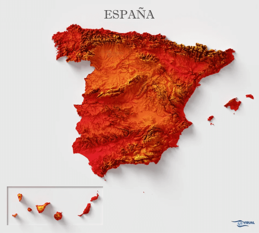
This is a shaded relief map of Spain.
The European country has a total land area of 195,346 square miles (505,944 square kilometers), according to Britannica. The kingdom boasts various plains and mountain ranges.
ThoughtCo notes that the nation’s highest peak is found outside of the mainland. It is the Pico de Teide (Teide Peak) in Tenerife island, part of the Spanish-owned Canary Islands located west of Africa. The peak stands at 12,198 feet (3,718 meters) tall.
Help us out by sharing this map:
Thank you for your sharing. I am worried that I lack creative ideas. It is your article that makes me full of hope. Thank you. But, I have a question, can you help me?
I don’t think the title of your article matches the content lol. Just kidding, mainly because I had some doubts after reading the article. https://accounts.binance.com/de-CH/register-person?ref=W0BCQMF1
Reading your article helped me a lot and I agree with you. But I still have some doubts, can you clarify for me? I’ll keep an eye out for your answers.
Thanks for sharing. I read many of your blog posts, cool, your blog is very good. https://www.binance.com/register?ref=IXBIAFVY
I don’t think the title of your article matches the content lol. Just kidding, mainly because I had some doubts after reading the article.
Your point of view caught my eye and was very interesting. Thanks. I have a question for you. https://accounts.binance.com/register/person?ref=IXBIAFVY
Thanks for sharing. I read many of your blog posts, cool, your blog is very good. https://www.binance.bh/register?ref=QCGZMHR6
Your point of view caught my eye and was very interesting. Thanks. I have a question for you.