Map by Milenioscuro / Wikimedia Commons
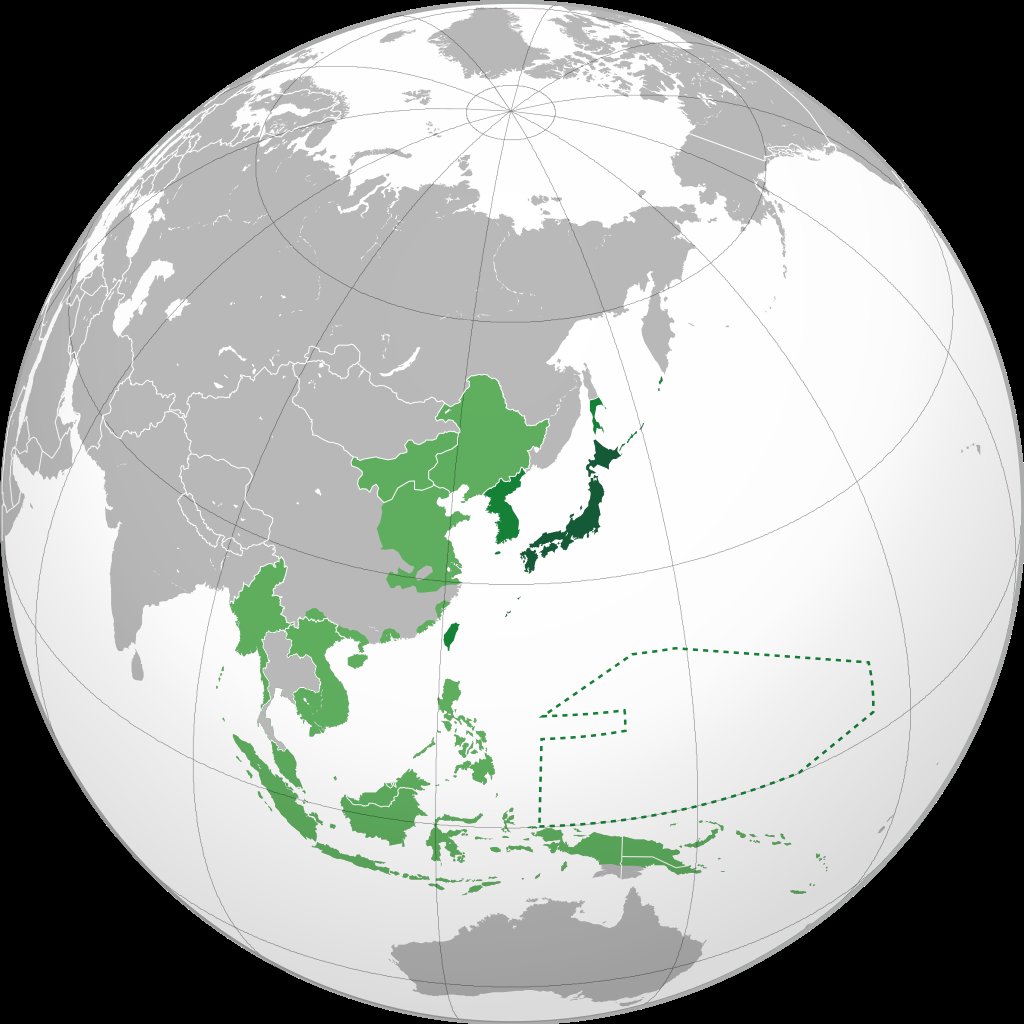
In 1942, the Japanese Empire reached its maximum territorial expansion during World War II. This map captures a moment when Japan controlled an enormous swath of East Asia and the Pacific, stretching from the Chinese mainland to the scattered islands of Oceania.
For modern readers accustomed to today’s geopolitical boundaries, this image offers a startling reminder of how dramatically the world has changed in just over eight decades.
From Island Nation to Regional Superpower
Japan’s transformation from an isolated island nation to a major imperial power happened remarkably quickly. By 1942, Japanese forces controlled Korea, significant portions of China, French Indochina (modern Vietnam, Laos, and Cambodia), the Philippines, Indonesia, Malaysia, and countless Pacific islands.
The green shading on this map represents direct control, while the dashed lines indicate the empire’s sphere of influence extending even further into the Pacific Ocean.
The Strategic Calculations Behind Expansion
This expansion wasn’t random. Japan sought natural resources that its home islands lacked, particularly oil, rubber, and minerals essential for industrial production.
The territories under Japanese control in 1942 provided access to these critical materials. The Dutch East Indies (Indonesia) offered oil, Malaya provided rubber and tin, and the Chinese territories held coal and agricultural resources. This resource acquisition strategy drove much of Japan’s military planning.
The Human Cost of Empire
Behind these neat territorial boundaries lay immense human suffering. Millions of people across Asia experienced occupation, forced labor, and military violence.
The map’s clean lines cannot convey the complex realities of resistance movements, civilian displacement, and the brutal nature of wartime occupation that characterized this period.
The Unsustainable Nature of Overextension
Looking at this map, one can immediately grasp why Japan’s empire proved impossible to maintain. The sheer geographic scale of these holdings stretched Japanese military and logistical capabilities beyond sustainable limits.
Defending such vast territories required resources that Japan increasingly lacked as the war progressed. Within three years of this map’s snapshot moment, the empire would collapse entirely.
Why This Map Matters Today
Understanding this historical moment helps explain contemporary East Asian geopolitics. Many current tensions in the region trace back to this period of Japanese expansion and the bitter memories it created. The map also serves as a powerful lesson about imperial ambition and the ultimately unsustainable nature of conquest-based power.
For history enthusiasts and curious readers alike, this map represents far more than territorial boundaries. It captures a pivotal moment when the world hung in balance, before the tide of war would turn decisively against the Axis powers.
Help us out by sharing this map: